It was April 1st, exactly three months before the date we hiked to Mount Whitney summit via Mount Whitney Trail, that I got invited to join the hike. There were five of us in the group: Roman, Paul, Mike, Vi and me. Roman, our leader, was awarded a permit with a June 29 entry date. He sent us a list of trails that we were to hike either individually or as a group. Due to differences in schedules and locations, our attendance as a group was perfect on only two occasions: the first day hike, and the last acclimatization hiking and camping trip. The list below shows the hiking and camping trips that I was able to join. Aside from these hikes, I did weight training and cardio exercises. I also made sure to test gear that I planned to take to Mount Whitney. You may click here to read about our Mount Whitney summit hike.
1. Day hike: Malibu Creek Backbone Trail Loop
Trail location: Malibu Creek State Park, Calabasas, CA
Total distance: Loop 14.5 miles
Altitude gain: 2,000 ft (610 m)
Maximum altitude: 2,500 ft (762 m)
Hike date: April 20, 2013
This was our first training hike. Except for Paul, this was the first time I met the rest of the group. There were several entrances to the park; we parked at Park Entrance Road. Our loop path was: Crags Rd, Bulldog Lateral, Bulldog Mtwy, Castro Mtwy, Mesa Peak Mtwy, Coral Canyon Rd, Backbone Trail, Las Virgenes Rd, and came back to the park via Waycross Dr. In this hike, we had some challenge locating the loop when we hit the gate leading to a facility. The Las Virgenes Rd segment of the loop was unexpected. We took pictures at the M*A*S*H film site.
 |
| Me, Mike, Paul, Roman and Vi at Malibu Creek M*A*S*H film site |
 |
| M*A*S*H prop at Malibu Creek |
2. Day hike: Mt. Baden-Powell via Pacific Crest Trail
Trail location: Angeles Crest Highway CA-2/Pacific Crest Trail, Valyermo, CA
Total distance: 8 miles
Altitude gain: 2,800 ft (853 m)
Maximum altitude: 9,400 ft (2,865 m)
Hike date: May 6, 2013
Although this was a short hike, the challenge was the altitude. The trails going to Mt. Baden-Powell summit were Pacific Crest Trail then Baden-Powell Summit Trail. At the time of our hike, there were small patches of snow at some segments of the trail. The trail was narrow and shaded most of the way.
 |
| Trail slope |
 |
| At the ridge |
 |
| Registry at Mt. Baden-Powell |
 |
| At Mt. Baden-Powell peak |
3. Day hike: Mt. Wilson Toll Road
Trail location: Angeles National Forest, Pasadena, CA
Total distance: 18 miles
Altitude gain: 4,500 ft (1,371 m)
Maximum altitude: 5,710 ft (1,740 m)
Hike date: May 11, 2013
This was a challenging hike because of the distance. Mt. Wilson Toll Road starts at Pinecrest Drive in Pasadena. The entrance to the toll road was gated, so we were mostly concerned about being locked in. The trail was well-maintained and had the most traffic at the first 3 miles up to Henninger Flats. As this was a toll road, it was unshaded most of the way.
 |
| At Mt. Wilson peak |
 |
| Mt. Wilson Toll Road |
 |
| Rest stop |
 |
| Rest stop |
4. Day hike: Mt. Baldy from Baldy Village via Bear Flat
Trail location: Mt. Baldy, CA
Total distance: 13 miles
Altitude gain: 6,000 ft (1,829 m)
Maximum altitude: 10,064 ft (3,067 m)
Hike date: June 1, 2013
The combination of vertical rise and altitude made for a challenging hike. Parking spots at the village were few. The trail was shaded most of the way, and the mountain air was cool. Although there were many people at the peak, there were not a lot of hikers at the Bear Flat trail.
") |
| At Mt. Baldy peak (Photo by Kara Perez) |
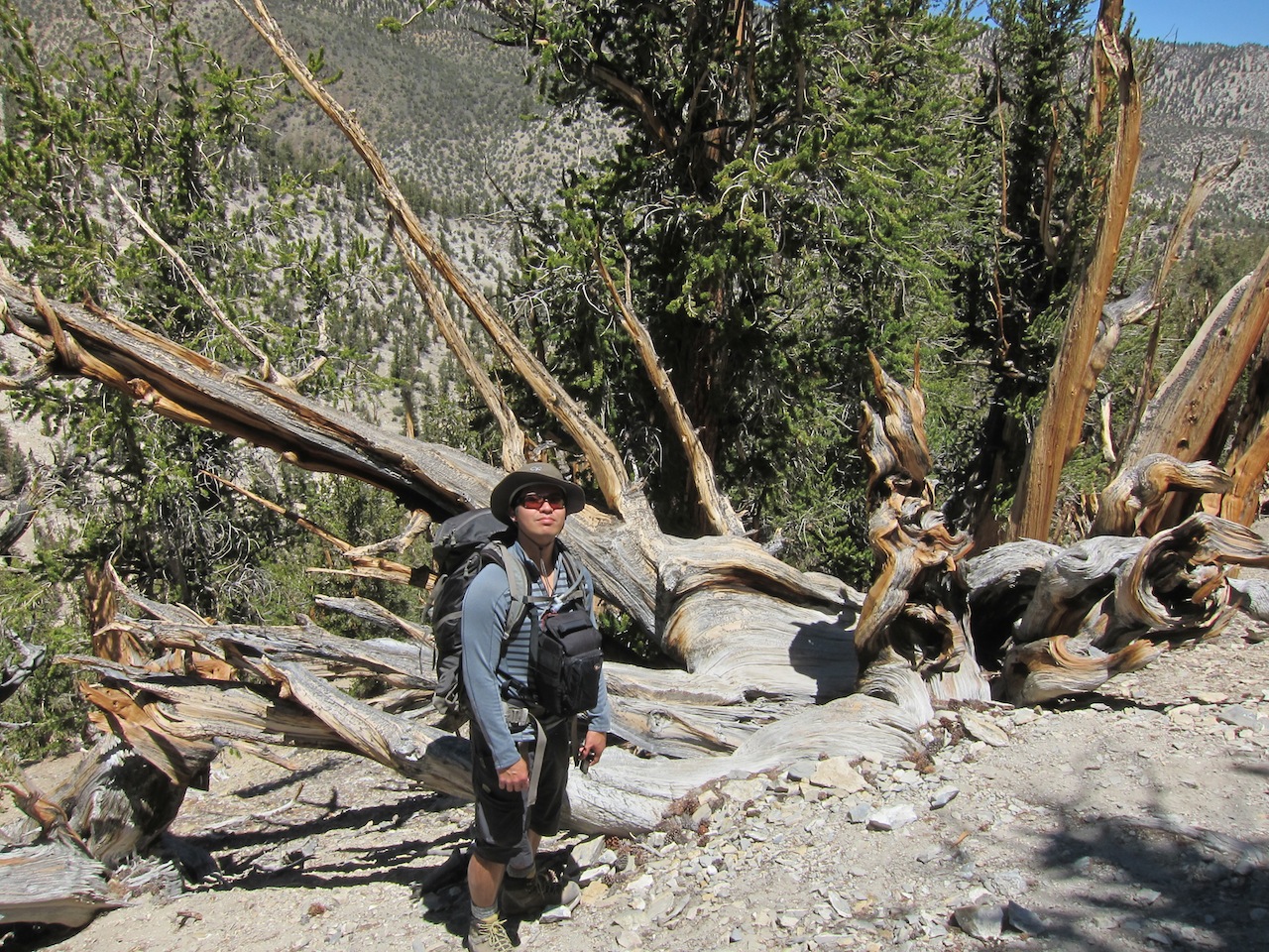
5. Acclimatization hike and camping trip at White Mountains
Location: Bishop, CADate: June 22-23, 2013
Trail: Methuselah Walk at Ancient Bristlecone Pine Forest
Total distance: Loop 4 milesAltitude gain: 1,000 ft (305 m)
Maximum altitude: 10,000 ft (3,048 m)
This was short and leisurely, but nevertheless a challenging acclimatization hike the weekend before the Mount Whitney summit hike.
 | |
| Stations |
 |
| Trail |
 |
| Flowers |
 |
| Stations |
 |
| Ancient trees |
 |
| Ancient trees |
Trail: Cottonwood Basin Overlook Trail at Patriarch Grove
Total distance: 0.5 mileMaximum altitude: 11,300 ft (3,444 m)
This was our last "training hike" as a group, which was a leisurely and fun hike. There were some "Vadering" and farting tricks.
 |
| Ride |
 |
| Backseat |
 |
| Cottonwood Basin |
 |
| Walk |
 |
| "Vadering" |
 |
| Barren peak |
Overnight camping: Grandview Campground
Altitude: 8,500 ft (2,591 m)We camped overnight, which was a great way to spend a Super Moon night. After dinner, some of us went out to take pictures of ancient trees.
 |
| "Glamping" |
 |
| Ancient tree |
Some photos taken by Paul Rojas. Used with permission.
http://facebook.com/
http://
No comments:
Post a Comment